August 4th and 5th
We left St. George early for the drive to Great Basin National Park. This park is located in eastern Nevada, about half way up the state. The park is really only a portion of what is known as the Great Basin, which covers the western half of Utah, all of Nevada except the very southern tip, and the southeastern corner of Oregon. The entire area is covered in sagebrush, divided by narrow mountain ranges, and is named for its lack of drainage. The streams or rivers in this area do not drain to any ocean, but into the lower elevations into shallow lakes and marshes- thus the Great Basin! These sagebrush deserts divided by mountains are almost like islands in the sea- the deserts create a physical barrier to many species of animals, so the animals that live on each "island"- the mountain ranges- develop unique adaptations to their surroundings.
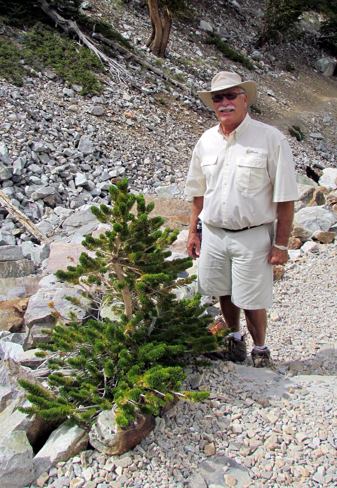
This park actually has two separate sections- the higher elevations including Wheeler Peak, which at 13,063 feet, is the second-highest peak in Nevada- and the Lehman Caves. Dale and I had decided to come to this park for one reason only- to see the oldest living organisms on earth. These "organisms" are Bristlecone Pine trees, found in only a few locations in the world, and always at high elevation in an environment of harsh wind, cold, and few nutrients. In this environment, these trees grow extremely slowly, their wood so dense it is resistant to insects and rot. By the time they reach old age, they often only have a few strips of bark left to sustain them. When they die- at ages ranging from 2000 to 3000 years, and sometimes longer- they erode away from ice, wind and rain rather than rot, often remaining standing for another 1000 years. Their needles can live up to 40 years. Unfortunately, before the area became a park in 1986, one of the older documented trees, named Prometheus, was actually cut down to determine its age! It turned out to be in excess of 5000 years old! Now, instead of cutting down trees to determine age, they use a borer to take a core sample of the tree, which allows them to count the rings without damaging the tree.
We stopped in the Visitor Center on our arrival, and determined that it was reasonable for us to drive up the 12 mile scenic road, which starts at about 6,800 feet, and ends at the campground, which is at 10,000 feet, then hike to see the trees. It is here that the 3 mile round trip trail, the Bristlecone-Glacier Trail, begins. The trail climbs about 600 feet in elevation over wooded paths, with the last 1/2 mile or so over rugged, loose rocks. We had some concerns due to the high elevation, but we had been over 4000 feet in elevation (other than Las Vegas and St. George) for the past 2 weeks, so figured we were pretty much acclimated to higher elevation. There is a self-guided loop that takes you through a stand of Bristlecones, with signs to provide information about the individual tree, as well as general information. Interestingly, the trees growing at the very edge of where they survive often live the longest. They grow the slowest, and are therefore more resistant to the things that can kill them! We did spot several small trees, but it is questionable, because of climate change, if these trees will survive as long in the future. It was certainly worth it to make the 2 1/2 hour climb to see these rare trees!
On completing the scenic drive, we decided to check with the Lehman Caves Visitor Center to see what tours were available. Unfortunately, it being after 4pm, all the tours had ended. We discussed returning the next day, but our lodging was over an hour away- Great Basin is very isolated- and it would be coming back in the wrong direction for our next destination. We decided to opt out of the caves. By the way, the Great Basin National Park came up earlier in our trip when we learned about the "dark sky" issue- it is one of the darkest locations in the continental United States. Guess the best way to see the stars would be to camp there, as I would not want to drive over an hour through the empty, desolate desert at night!
 |
| At treeline |
 |
| Our first Bristlecone |
 |
| Bristlecone number 2 |
 |
| Another Bristlecone Pine |
 |
| Butterfly along the trail |
 |
| Live Bristlecone |
 |
| Mule deer |
 |
| The next generation |
 |
| On the trail- note the drop-off |
 |
| The trail up... |
 |
| View of the glacier on Wheeler Point |
 |
| View of Wheeler Point at 13,063 feet |
We left the park to drive to Ely, over an hour away, where we will spend the night. On the way out of the park, we saw several mule deer grazing, one of whom could have cared less that we wanted his picture. We planned to drive to Salt Lake City the next morning.


Hi,
ReplyDeleteI had to read a lot today to catch up - I didn't know you were going on this trip. What beautiful pictures! I love that you write this blog - it must take a long time! Enjoy your trip - I'll be traveling vicariously through you!
Becky
Thanks for following us! Sorry, thought you knew we were going. Your comments are appreciated!
DeleteAlso- if you double-click on the photos, you can enlarge them. You may know this already.
Hope to see you on our return to N. England!
Dale and Paula