Friday, July 27, 2012

Steamboat Springs

July 23-26

Dale and I decided to take a few days off to play golf and relax.  We had been to Steamboat Springs about 5 years ago and enjoyed it, so headed there.  Steamboat Springs is well-known to skiers, both for the quality of the ski runs and its role in the history of establishing ski jumping here in the U.S.  However, unlike many "ski towns", Steamboat existed as part of the western frontier prior to the arrival of the skiers.  As legend has it, the town was named for the numerous springs found in the area, in particular one that made a chugging sound, similar to a steamboat, as it spewed water 15 feet into the air.  Unfortunately, after the railroad was put in, the chugging stopped.  To celebrate the frontier spirit (and to not be outdone by Kate) I purchased a cowboy (girl) hat at F.M.Lights, which has been around selling western gear for over 100 years.

On Wednesday, we played golf at a local public course called Haymaker.  The course was in great shape, though somewhat pricey for a public course, and we enjoyed the round.  As usual, did not play as well as we would have liked, but had fun anyway.  After, we wandered the downtown area.  It has interesting old buildings that are now shops and restaurants, and there are flowers everywhere- hanging pots, barrels, and window boxes.  Several restaurants have outdoor seating, which gives the downtown a friendly, social feeling.

The next day, we decided to explore some of the natural areas surrounding Steamboat.  In spite of the extensive building of condominiums on the sides of every mountain in the vicinity, there are still some places to experience nature.  We drove up to a National Forest recreation area known as Fish Creek Falls.  It became part of the National Forest through the efforts of Bob Adams, who recognized that, unless the area was protected, the general public would be excluded from this beautiful area.  It was a nice walk on paved walkway to view the falls, which is about 285 feet high with a free fall of 60 feet.  There was sufficient water to make the falls really beautiful.  We then walked down to the base of the falls, where a walking bridge spans the river.  The view from the bridge was great.

We then drove to Rotary Park, where we walked a boardwalk into the wetlands and viewed the Yampa River.  The Yampa is a tributary of the Colorado River, and is important to Steamboat as a water source, and as a focal point for many activities.  We walked into town and viewed the springs that are the town's namesake.

Windmill on road to Fish Creek Falls

African Daisies on walk to falls

Fish Creek Falls from overlook

Falls from the bridge

The Yampa River

Yampa River occupants...

Street view of Steamboat Springs

Steamboat Spring
It was a wonderful, relaxing time.  Friday morning we are off to Utah to visit Arches and Canyonlands National Parks.

Wednesday, July 25, 2012

Rocky Mountain National Park

July 22nd

On Sunday we left Laramie and headed towards Estes Park, CO, the gateway to the Rocky Mountains.  We had visited Estes Park about 5 years ago on a trip to visit my sister.  At that time, when we arrived in town, there were herds of elk wandering all over the town, congregating around the Visitor Center in particular.  We were disappointed that we did not see a single elk this time.

Estes Park is a lovely town, bordered by the Big Thompson River.  There is a walkway along the entire river behind many of the shops and restaurants, making a great focal point for socializing.  As you might expect, there is everything from high-end restaurants and art shops to take-out and tee-shirts.  A great little town to explore.

The next morning we headed over the Trail Ridge Parkway, which bisects the park. This road reaches elevations of over 12,000 feet, and is dwarfed by surrounding peaks of over 14,000 feet.  It is billed as the most scenic drive in the country, and I would believe it.  For those of you that have never driven it, add it to your bucket list. I would recommend, for those who might be nervous about driving mountain roads, to drive it east to west (Estes Park to Grand Lake), as it is easier to drive up the steeper east side than down! We had driven this road the last visit, but quickly drove to the Alpine Visitor center just below the highest point of the road, in order to do a ranger-led hike.  As a result, we missed most of the scenery.  I do remember there was much more snow last time, as we were here a month earlier.

The views from the numerous overlooks were spectacular.  We walked out to several viewpoints and were pleased to see several marmots (part of the squirrel family, but much bigger) that live at these high altitudes, hibernating for about 8 months of the year.  The several we saw were pretty fat!  At one of our stopping points, we found quite a few wildflowers.  We had intended to take a short hike at Deer Ridge Junction into several lakes, but there were so many people on the road, there was no where to park at the trail head.  Rocky Mountain National Park is one of the most visited parks, and there is some concern with the amount of pressure all of these visitors cause on wildlife and the delicate terrain in this alpine tundra.  If trampled, tundra plants can take up to a decade to recover.


After crossing over the summit, the drive down the west side is more gradual, but does not have the spectacular scenery seen on the east side.  There are more trees, primarily evergreen, and open marsh land.  We just missed seeing a moose in one of these areas- we knew there had been one by all the vehicles pulled off the road!  The parkway ends near a town called Grand Lake.  We drove in for lunch- what a cute little town!  The sidewalks are all wooden, like you see in old westerns.  The main street has many shops and restaurants, the road parallel to main runs along the lake.  There were lots of folks boating, swimming and hanging out.  It was great weather, and people were really enjoying it.  In this area, the damage done to the Ponderosa Pines by the pine borer beetle is really evident- it appeared that more than 50% of the trees were dead or dying- much higher than we saw 5 years ago.  We ended our day in Steamboat Springs, where we intend to spend a few days to golf and relax.


Tuesday, July 24, 2012

Rodeo- The Daddy of Them All!

July 21st

Neither Dale nor I had ever been to a rodeo.  On our 2009 trip, it seemed as if we kept missing them- it was last week, or it was coming next week.  Because of our change in itinerary, it opened up an opportunity to go to Cheyenne, Wyoming, for Frontier Days.  This is billed as the biggest rodeo in the world, with Calgary in Canada as number two.  The added bonus for Dale is that we decided to stay outside Cheyenne in Laramie.  About 57 years ago, Dale went to Laramie for an Order of the Arrow (Boy Scouts) conclave which was held at the University of Wyoming.  We spent an evening driving around the UW campus to see if he could figure out where he had stayed.  Obviously, after 57 years, not only has the memory weakened but the campus has changed immensely.  He clearly remembers looking out over the prairie from the dorm he was staying in and seeing a ranch in the distance that he was told was 30 miles away.  Now, there are so many buildings, the view of the prairie is blocked.  It was fun, anyway.

We went to the rodeo early on Saturday, as we were concerned we may not get tickets.  They seemed to have plenty left (we chose seats under cover, as the temperature was to be in the 90's), and since nothing really started until 12:45, we wandered around looking at the little temporary shops and walked through the Indian Village set up on the grounds.  Great people watching, with lots of cowboy hats and boots, as well as other unusual outfits... We had great barbecue for lunch, sitting on the grass in the shade, chatting with folks who knew some of the riders and with others who had come some distance just to see the rodeo.  We were told this was the best rodeo to see as our first.

Our seats were in the "nosebleed" section, but we had no problem seeing the action.  There were demonstrations of fancy riding, speeches from politicians, and an opening parade.  There were several events- bareback bronco riding, saddle bronco riding, bull riding (scary), calf roping and  steer wrestling,          where a cowboy chases a steer on horseback, than jumps off the horse onto the back of the steer and wrestles it to the ground.  The steers are huge, and so are most of the cowboys who participate in this event.  The leader at the end of Saturday in the saddle bronco riding was a young man named Will Smith from South Carolina.  Who knew we had cowboys in South Carolina?

The arena

Opening Ceremonies

Bull Riding

What??

Bare-Back Bronco Riding

Calf Roping

Saddle Bronco Riding
We had a great time watching the events, and I had fun trying to catch some good photos of the action.  As I mentioned, the bull riding was a little scary, as the bull always seemed to be out for revenge once he tossed his rider.  They had lots of other riders around to distract the bull, along with the clown whose job it is to attract the bull's attention.   No one got injured, but the bull certainly wanted to do a little stomping on the guy once he was down!  The bronco riding was fun.  The horses have as much of a reputation as broncos as the cowboys do as riders.  There were several champion broncos in the show. Once they dumped their riders, their main interest seemed to be running around the arena while the riders tried to catch them.  The one we did not enjoy as much was the calf roping, as those poor little guys really went down hard once they were roped.  We enjoyed our day- probably don't need to do it again!


Monday, July 23, 2012

Great Sand Dunes National Park

July 19th

After spending the night in Trinidad, Colorado, our first stop was at Great Sand Dunes National Park.  The first view of the dunes from the access road is just strange- you can see piles of white sand against the Sangre de Christo mountains.  It is not until you get closer that you realize the immense size of these dunes- some as high as 750 feet- extending for miles.  During the snow melt season, Medano Creek flows at the base.

It is really as a result of water that these dunes exist.  Medano Creek and Sand Creek both flow out of the mountains, bringing with them tons of sand worn from the rock.  Once the sand reaches the flat land, the strong prevailing southwest winds, often reaching 40 miles per hour, blow the sand back up into the dunes.  Because of the growing awareness of the importance of water in the protection of this area, a preserve of surrounding lands has been established.

When we arrived at the park, we went to the Visitor Center and watched a very informative film on this area.  We decided we would try to hike to the top of the nearest large dune, as according to the ranger, it was about 2 hour hike and the view from the top would allow us to see many more of the dunes.  Those seen from the visitor center account for only about 1/3 of the dunes.  We applied sunscreen, hats, sneakers and took our walking sticks and water.  We headed out, soon realizing that walking in the loose sand took a great deal of effort.  We continued on for about 1 hour and were still a long way from the top of the dune. We decided to call it a day and turn back, but glad we had given it a shot.

The view from out there is just amazing, looking at these massive dunes in an area where they shouldn't be....   it was truly an experience to see them.  The dunes are constantly sculpted by the winds, forming sharp ridges and deep gullies.  The soft sand flies easily in the wind.  Although the dunes appear barren, there are small plants and animals that thrive here (we only saw footprints, we think of a kangaroo rat..)  There is one insect, the Great Sand Dunes tiger beetle, that lives no where else in the world.  

Great Sand Dunes

All prepared!

View from the dunes

Deep gully

Wind sculpture

Shadows on the dunes

Dunes against the mountains
Fox on grounds of AF Academy

The Cadets Chapel
We stayed in Colorado Springs that night, and decided to go to the Air Force Academy to see the chapel.  We had been in this area once before, but did not go.  Driving through the city, you could look up to the mountains to the west and see miles of burnt-out area.  It must have been a hellish view during the recent wildfires!

When we first arrived on the grounds of the Academy, a large fox ran across the parking lot in front of us, stopping to drink water from the gutter.  We wondered if he was displaced during the fire...The chapel at the academy was very interesting with its 17 spires.  We were disappointed, though, to find that it was not open to the public, as we had understood that it was.  The academy is in a beautiful setting, so spent a few minutes walking around, than back on to 25 north.

Thursday, July 19, 2012

Crossing Oklahoma

July 17th & 18th

Neither Dale nor I had ever been in Oklahoma before, so rather than just driving through, we wanted to see a little of the state.  We stopped at an Information Center after crossing from Arkansas to see what was available.  The person there provided us with a lot of information, most of which was in Oklahoma City.  Since we were not going that direction, we chose to see something near the center.  In Sallisaw, we visited the site of Sequoyah's cabin.  We had never heard of him (as most of you have not), but he was a very interesting person.  He was born in the late 1700's of a white father and Cherokee mother.  He was a blacksmith, silversmith, and trading post owner.  Although he was illiterate, he was aware that whites often communicated via "talking leaves".  He wanted to create a way for the Cherokee nation to do the same.  Over the course of 10 years, he created a written language of symbols based on the sounds that form Cherokee words.  The language was simple enough for everyone to learn in just a few days and, within a few short years, the majority of Cherokees could read and write.  The first newspaper in the Oklahoma area was actually written in Cherokee.  The site we visited was a cabin built by him.  It was enclosed in a stone building by the WPA in order to preserve it.  It is a beautiful setting, and the gentleman who manned the visitor center was extremely knowledgeable.  If Sequoyah's name sounds familiar, it should- the Sequoia's in the northwest were named for him.  I do not as yet know the connection, but will research to find out!  In addition, we realized we had seen a statue of him in the State House in Washington D.C. this spring, representing Oklahoma.

Statue of Sequoyah

Sequoyah's Cabin

Tallgrass Prairie

A handsome pair

Part of the Tallgrass herd of bison

In reading through some of the information from the Visitor Center, I realized that Oklahoma has a preserve for Tallgrass Prairie, located in the north central part of the state in Pawhuska.  I had recently read an article in the National Parks magazine about Tallgrass Prairie in Kansas, so was interested in seeing the preserve.  It did not appear to be much out of our way to Colorado.  Tallgrass Prairie used to cover the entire mid-section of our country.  It was what the pioneers first saw when they traveled west.  Less than 10% of this prairie habitat remains.  The preserved area has never been plowed, mowed, or otherwise disturbed, allowing the grass to grow "as high as a buffalo's belly".


 When we arrived, we realized that the perimeter road leading to the Visitor Center for the preserve was gravel road- oh yay, our first dirt road on this trip! We determined we had come that far, we would proceed.  What a spectacular area!  Tall grasses waving in the breeze for as far as you could see.  The preserve covers 39,000 acres and is managed by The Nature Conservancy, an organization I have always admired.  Ten years ago, they repopulated the area with bison, long gone from this area, but abundant years ago.  They now have a population of 2400, and are trying to keep it at that level to maintain the health of the herd.  Shortly after entering the preserve, we came up on a herd that had to have several hundred animals.  About a 1/2mile further on, we spotted another hundred or so- lots of babies in the group!  It is always exhilarating to see these animals in what is as natural a habitat as is available in the states.  Just beautiful!

We traveled the 15 miles (over gravel) to the Visitor Center, where we spoke to a volunteer.  He told us that the bison are rounded up every fall to be examined, receive vaccines such a Brucellosis (a disease of bison and cattle), and to cull the heard to maintain the ideal size.  Although, according to the volunteer, there has not been any documented transmission of Brucellosis from bison to cattle, "it makes the ranchers feel better if we immunize the herd."  If you don't mind gravel roads, this is a great spot to visit.  One can only imagine what it would be like out there at night- how many stars would you see?

The trip out was a little nerve-wracking.  Again, gravel roads for miles, Bitchin' Betty (our GPS) telling us to take turns that were nothing but dirt tracks (we didn't listen), and finally breathing a sigh of relief when we hit blacktop again.

Oklahoma is a long state- especially when traveling through the panhandle.  The next morning, we realized we had only made about one hour of progress towards our goal of Colorado- after spending the entire day in the car!  We resigned ourselves to a long day driving through open prairie, seeing scattered ranches and cattle, flat,flat land....  We did see some beautiful views of rain clouds in the distance over flat mesas... but were very happy to cross the border into Colorado.

Wednesday, July 18, 2012

Hot Springs National Park

July 16th

After driving south, than southwest, through Tennessee into Arkansas, we arrived at Hot Springs National Park.  Hot Springs National Park is located in the western part of the state.  How to describe this park?  The National Parks book describes it as "peculiar", which it is, especially in light of what we have come to expect from our parks.

Hot Springs Mountain is the source of many hot springs, created by water seeping into the depths of the earth, gradually being heated to 140 degrees, than forced up through cracks in the earth.  For years, humans have seen the hot springs as medicinal, using them to treat and cure many diseases.  When private individuals in the early 1800's began to lay claim to individual springs, the federal government stepped forward in 1832 to protect the resource for all citizens as a national reservation.  It became a park in 1921.

The park encompasses Hot Spring Mountain and Bathhouse Row, a row of Victorian buildings located along Central Ave. that were previously commercial bathhouses.  One of the more luxurious, the Fordyce, is the park's Visitor Center.  There are only a very few commercial bathhouses remaining.  The rest are or have been renovated by the Park Service to lease to private businesses.  The numerous springs on the side of the mountain in back of Bathhouse Row have all been capped to maintain their cleanliness and are stored for use by the remaining bathhouses.

One of the Bathhouses on the Row

One of the treatment rooms in the Fordyce

The lounge

The "demonstration" spring
We visited the Fordyce and toured the building, which has been restored to how it looked during its  hay day- including all the weird exercise equipment- and includes displays of the services offered during that time.  It was interesting, the building was beautiful, but the park was disappointing.  We had been lead to understand that there were still natural springs on the mountain that could be viewed.  The only springs visible were a "demonstration" spring built to show how it looked in nature, and several springs piped to fountains in the Bathhouse Row area.  In essence, nothing of the natural springs remains except the water.  It is still unclear to me what happens to the thousands of gallons of water produced by the springs every day.  If you are in the area, it is worth visiting to get a glimpse of the culture of the time, but don't make a special trip.

Tuesday, July 17, 2012

Mammoth Cave National Park

July 14th

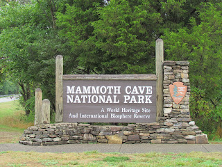
We arrived at Mammoth Cave National Park late in the day.  The park is located about two thirds of the way across Kentucky.  Because it was so late, many of the tours we preferred were sold out, so we opted to purchase tickets for a Sunday morning Historic Tour.  Many tours are available, from self-guided short tours of the main cave to tours that any spelunker would like.

The caves were formed by an underground river thousands of years ago.  It has been explored intermittently over the past 4000 years. At present, 365 miles of cave have been surveyed, which makes it twice as long as any known cave.  Geologists think it could be many more miles of cave to be discovered.

We chose the Historic Tour, which was 2 hours long covering 2 miles of cave, as it shows the original area discovered and explored in the early 1800's by Stephen Bishop, an enslaved person, who actually became a guide for visitors to the cave.  His name can still be seen written on the walls in parts of the cave.  Mammoth Cave was named that for a reason- the rooms are quite large.   There are several large halls, including the Mammoth Dome, which is 192 feet from floor to ceiling.  There are a few tight places (one is known as Fat Man's Misery), but speaking as a mildly claustrophobic person, this should not bother most people. I did not have a moment of discomfort. We were happy, however, that we brought jackets.  The temperature in the cave was quite cool and mist could be seen exiting the cave entrance where the cool air meets the warm humid air outside. The ranger guide was very knowledgeable, and the cave was spectacular.  I would definitely recommend this park for a visit.

Interestingly, the stalagmites and stalactites most people associate with caves are not present here.  The roof has a solid shell of rock that does not allow the slow leaking of water needed to form these structures.  According to the ranger, one of the tours, called Frozen Niagara, does show a cave that has some of these features, but the majority of Mammoth is wide open. 

 Regarding wildlife, we saw numerous wild turkeys and several deer on our drive in and out of the park.  There are bats in the cave and one did fly over us during the tour, but the ranger indicated that was the first one he had seen during a tour.  There are also cave creatures, including the eyeless cave fish and the eyeless cave crayfish.  No need for eyes in absolute darkness!


Dale enjoying the cave- but not the flash!

The entrance to Mammoth Cave
White tailed deer


Following a picnic in the park, we headed southwest into Arkansas, where we will visit Hot Springs National Park.

Monday, July 16, 2012

Cumberland Gap National Historic Park


We arrived at Cumberland Gap fairly early in the day, hoping to miss the predicted rain.  The park was established to recognize the historic significance of the gap.  It was originally used as a pathway through the Appalachians by animals, including bison.  The Indians followed, allowing them to trade with distant tribes.  Danial Boone was one of its earliest explorers, using it to find the legendary Kentucky.  The Gap was too narrow for wagons, so the 200,000 plus pioneers traveled the area on foot or horseback, carrying everything they owned on their backs.  This route allowed the west to be settled.  Daniel Boone eventually moved his family to Kentucky via this route.

During the 1920's, a road was built through the gap, allowing auto traffic.  It was closed after completion of a tunnel in 1996 and the area was re-naturalized in 2002.  Although the brochure indicates it has been returned to its original look, I think it will be another 20 years, after the trees have grown in, that it will look more like it looked during the time of the pioneers.

 After going to the Visitor Center and speaking with a ranger, we decided to take the 4 mile scenic drive to Pinnacle Point.  At 2440 feet, it overlooks the gap.  In the distance you can see several towns, the area where the tunnel is located and Fern Lake.  We then drove down to a parking lot where several trail heads are located.  We headed out on Object Lesson Trail.  This trail was built with hard-packed gravel  in the 1800's to demonstrate the convenience of having good roads for travel and to encourage citizens to vote money to improve roads- thus the name.  I guess it worked...  The trail took us to the Gap itself.  You can still see where the road went through, the trees are coming back, but are still small.  Would love to see it again in 20 years!


We headed back to the Visitor Center to view the film on the history of the Gap.  The primary focus was on Daniel Boone and his role is expanding this country.  After lunch in the car, we headed west towards Mammoth Cave National Park.