Thursday, August 25, 2016

Glen Canyon and Lake Powell

Monday, August 22nd -  We had scheduled a boat tour of Lake Powell that would take us into Antelope Canyon by water.  It was a short, picturesque drive to the marina, and after a short wait, we were off. During our wait, we saw a road runner, who posed for us on the walk.  Shortly after this photo was taken, he leaped out and grabbed a lizard! On the way in to the marina, we passed several very large houseboats being towed out by truck.  This area is well-known for houseboats, and many rental opportunities are offered.  There is a lot of water to cover- Lake Powell is 185 miles long and has 1960 miles of coastline, more than the coast of California.  The water is a lovely pale blue (when the sun is out) and the contrast with the orange and white rocks of the shoreline is beautiful.  There are lots of opportunities for recreation, with boating, water skiing, kayaking, etc.
     There are several interesting features on the lake, including a rock formation known as The Castle, the "bathtub ring", and the dam, which is one of the highest in the United States.  Although the dam produces electricity, its main purpose is water storage.  The bathtub ring, a distinct white band around the reservoir, was caused back in the early 90's when the water level in the reservoir was much higher than normal.  When the water finally receded, it left a white ring from leached out minerals on the rocks.  Visible in the distance were the 3 chimneys of a Navajo-owned coal-fired electric plant.  The plant produces more electricity than the dam, and is considered the cleanest coal-fired plant in the country.  They use a low ash coal, and have installed scrubbers and other equipment to accomplish this.
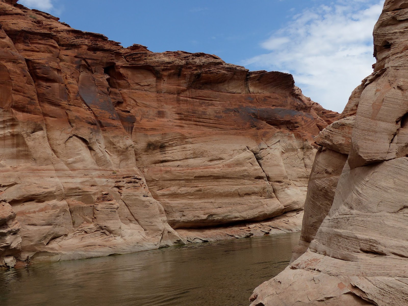
     It was beautiful going into Antelope Canyon, colorful rocks on each side of the boat.  We were unable to go in as far as usual, as the water level on the lake was lower than normal.  On the way back in to the marina, we could see the boat ramp- the widest one we had ever seen- guess to accommodate the big houseboats.   A great trip!  My only regret was not getting into the slot canyon.
     Following the boat trip, we had a great lunch overlooking the lake, than back in the car for the 2-3 hour trip to Monument Valley.


Vermilion Cliffs and Horseshoe Bend, AZ

Sunday, August 21st, afternoon- Our next destination was planned to be the Glen Canyon area, near Page, Arizona.  However, to get there, we wanted to be able to see the Vermilion Cliffs.  I knew we had driven Rt. 89 in 2009 on route to the north rim of the Grand Canyon, but could not remember if it was 89 or 89A... We wanted to go a different route than in the past, but 89A was the one that drives right along the edge of the cliffs- so that's what we did.  We realized after the fact that we had done this drive before.  The drive is spectacular, so repeating was not so bad.
     Vermilion Cliffs National Monument is one of 5 monuments designated in 2000, and managed by the Bureau of Land Management rather than the park service.  It is remote and primitive, and will most likely never see improvements such as visitor centers and parking lots.  It is identified by several small signs- which we did not even see- and there are wilderness hiking trails available.  Just not sure how you find them...  The monument covers 280,000 acres and the cliffs rise anywhere from 3100 feet up to 7100 feet.  There are 5 "steps" that lead to the highest elevation of the Colorado Plateau.  Route 89A actually travels along step 1, on something called the Chocolate Cliffs.  Vermilion Cliffs is step 2.  The escarpment, named for its brilliant red color from iron oxide in the soil, runs about 30 miles.  This drive is just beautiful.  If you are looking for a scenic route between Utah and Arizona, this is it.


     We arrived in Page, Arizona, in the middle of the afternoon.  While checking in to the hotel, Dale noted a photo in the lobby of the iconic Horseshoe Bend of the Colorado River.  He asked if it was in the area, and turns out it was a mile down the street!  We decided to go right there.
     The parking lot was almost full when we arrived.  The round trip hike to the edge of the canyon was about 1 1/2 miles up and then down a sandy dune.  We made it down to the edge and were in awe of how beautiful it was.  Both Dale and I tried to find a location to photograph the whole horseshoe, the shot we had seen in the hotel.  We just couldn't get the whole thing, and discussed how they managed to do that.  I went on line to look and found one used a drone, others used a very wide-angle lens.  So, bring your wide-angle if you decide to try this one- also your nerves of steel so you can get close to the edge....


Wednesday, August 24, 2016

Cedar Breaks National Monument

Sunday, August 21st-  This one definitely has the "wow factor".  Cedar Breaks is located just east of Cedar City, Utah.  Leaving
I-15 at 5800 feet you quickly climb to over 10,000 feet over curving, steep mountain roads.  When we arrived at the Visitor Center parking lot, we found cool, crisp air- cool enough to grab our fleeces before the short hike through the woods to see the view. As the National Parks brochure says, there is nothing subtle about Cedar Breaks National Monument.  Its huge amphitheater, over 2000 feet deep and over 3 miles in diameter, was formed by the same geologic forces that formed many other of the beautiful areas found in Utah and Arizona, including Bryce, Zion and the Grand Canyon.  Below the rim, the slope falls off sharply revealing brightly colored spires, arches, columns and steep walls.  The colors range from reds to purples to yellows... just spectacular!  The area was named by settlers, who mistook the Junipers at the base of the basin for Cedars, and used breaks to describe the rugged terrain.       We walked out to the first viewpoint- no fences, so I did not get to close to the edge- and marveled at the beauty.  We walked over to the Visitor Center, a lovely log cabin built by the CCC during the 30's and found another overlook, edged by a heavy log fence.  Much more comfortable getting close and getting good photos!  The interior of the cabin was cozy, with a fire place in use, and friendly park rangers.  In doing some further exploration, we ran into another ranger and asked about the bristlecone pines.
     Bristlecone pines are among the oldest living things on earth.  In previous travels, we hiked up to see the oldest of these trees in Great Basin National Park in Nevada.  Those trees were close to 5000 years old.  Back in the old days, they actually cut one down to see how old it was- it was 5000 years old!  Now they have an instrument that can take a core sample in order to determine age without killing the tree.  The oldest tree at Cedar Breaks is about 1500 years.  The ranger directed us to another viewpoint several miles down the road where the Alpine Trail begins.  She indicated that most of the trees were near the beginning of that trail.  We drove down, walking through more wildflowers to reach the trees.  They are a very distinct tree in appearance, not many branches, very tight, short needles and tight cones.  In addition, they are found clinging to the edge of the cliff, where conditions are harsh, and where there is little competition from other growth.  The pines looked much healthier with more visible needles than those in Nevada.  They grow so slowly that their wood becomes very dense and hard.  When they die, they do not rot, but wear away from wind and rain.  Pretty amazing trees!
     We did not see any animals up here except a few birds and chipmunks.  However, the area does support large mammals such as Mule Deer and Rocky Mountain Elk.  The other animal that is of some significance here is the American Pika.  The Pika is a small relative of the rabbit, well-adapted to high-elevation, cool climates.  It does not hibernate in the winter, so requires a large amount of grassses and dried plants to survive the winter, and spends its entire summer collecting.  The problem is they can not tolerate temperatures over 80 degrees and, with our warming world, their only option is to go higher to stay cool.  Obviously, there are limits to how high they can go.  Some Pika communities have been trapped on these mountain "islands" and are not able to migrate long distances to cooler areas.
     After a final look at the amazing amphitheater, we headed further east, coming down the mountain (actually the Markagunt Plateau), and were surprised to see a section of the slopes of the plateau covered with lava rocks, aspens and other trees growing up amid the black rocks.  Wonder how this plateau was formed?
     Our next stop would be the Page, Arizona, near Lake Powell and the Glen Canyon area.


Monday, August 22, 2016

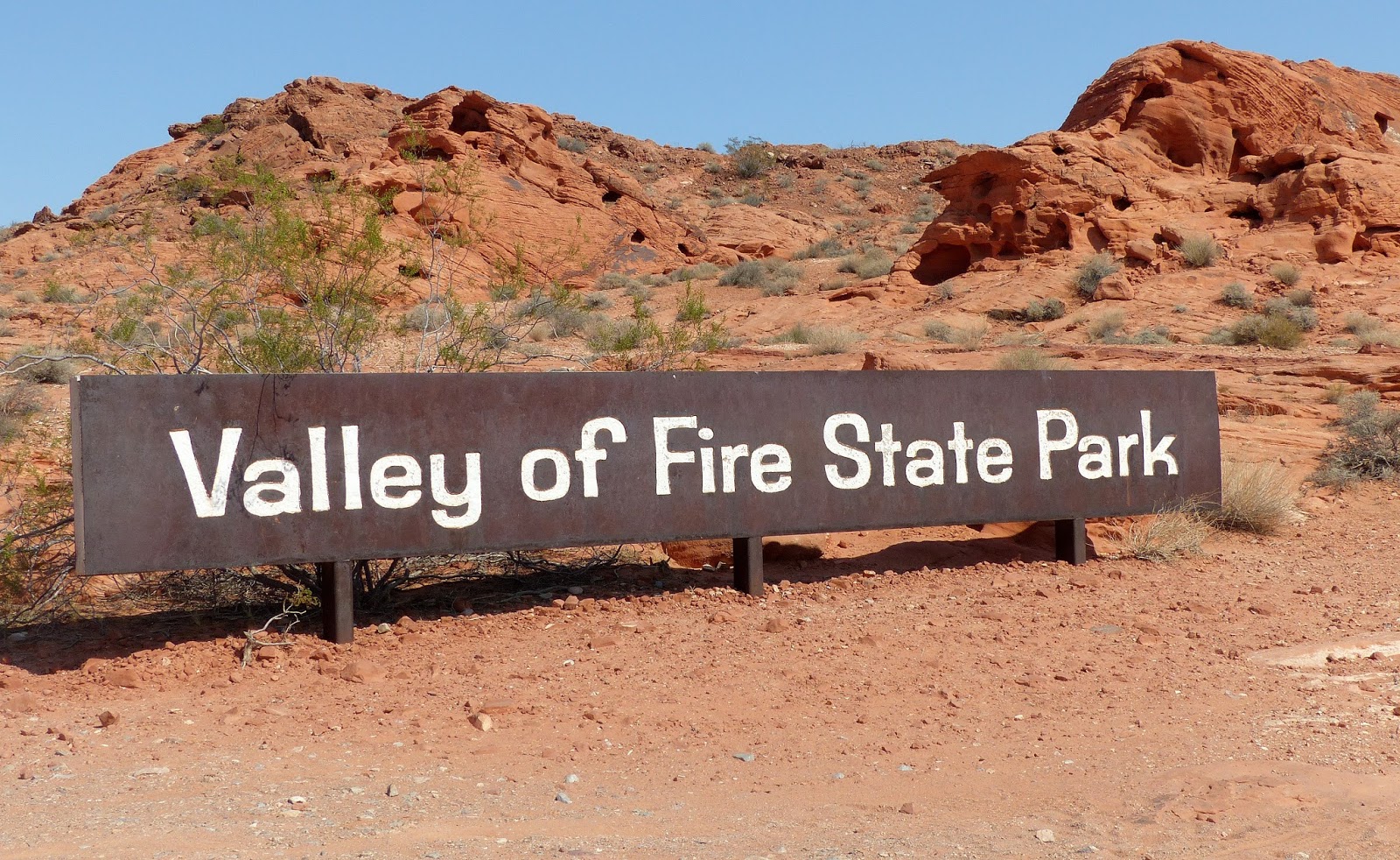
Valley of Fire State Park, Nevada

Saturday, August 20th- The Valley of Fire State Park is located about half way between the Utah border and the city of Las Vegas. The park covers 36,000 acres, and is about 4 miles long and 3 miles wide.
     It took us about 1 1/2 hours to drive to the east entrance of the park. We visited the very nice Visitor Center, watched a brief film, and picked up sandwiches for lunch.  On the advice of the ranger, we took the White Dome scenic drive.  He noted they were advising people not to hike today due to the high heat. The temperature was over 100.  The road passes a number of rock formations, many a vibrant red in color (where the park gets its name), and further in on the drive, white formations, some with pink mixed in to the coloring.  Lots of unusual formations.  Very pretty.
     We ran into two women from Asheville, NC, at several of the scenic stops.  They were on their first trip to the West, and were just so excited and amazed at the beauty of the area.  Always great to see!
     On our return trip on the White Domes drive, we spotted a pair of bighorn sheep up on the rocks by the edge of the road, and were able to get a shot.  It was great to see the same species we had seen earlier in Glacier in such a very different environment- in Glacier it was cool, very high elevation of over 10,000 feet.  Here it was over 100 degrees and an elevation between 2000 and 3000 feet.  Just amazing how adaptable animals can be.  Yet, on the other hand, some species can be very specific as to the environment they require to survive.
     We returned to St. George in mid-afternoon.  St. George is a dynamic small city of almost 75,000 at an elevation of 2840.  In spite of the elevation, it is in a valley and gets very hot in the summer.  Normal days can be close to or over 100 degrees.  I settled in to our hotel room to work on the blog- someone has to do it!- while Dale went searching for new sneakers.  A relaxing afternoon.  We planned to return north on I-15 tomorrow to see Cedar Breaks National Monument.


Grand Junction and the Grand Mesa

Wednesday, August 17th thru Friday, August 19th-  Grand Junction is a nice little city, about 60,000 in population,  located about 30 miles east of the Utah border.  It is named for the conjunction of the Colorado and Gunnison Rivers.  The surrounding Grand Valley has become an agricultural center, growing lots of fruits and vegetables.  In addition, many wineries have grown up in the Valley, and a wine tour is definitely on the list for a visit. Other than the wineries, Grand Junction has a lot to recommend it as a "tour" stop, as the Colorado National Monument is located just outside of town to the west, as is the Grand Mesa in the east.  The Monument is a 32 square mile section of red rocks, cliffs, fascinating rock sculptures, and one of the best scenic drives in the West.
      Linda and Larry suggested a trip up on the Grand Mesa, a large flat-topped mountain not far from their home.  In fact, it is the largest flat-topped mountain in the world, rising 11,332 feet high at its highest point.  It boasts over 300 lakes and covers over 500 square miles.  We had been up before, but not for a long time.  Plus, Linda and Larry had discovered the old road to the top and thought it would be a pretty, different way to go up.
      We drove up the usual access, then located the old back road, which is gravel.  We were happy Larry was driving his truck and not our car!  The road turned out to be rougher than anticipated, with areas of washboarding.  To make matters worse, as we neared the high point of the road it began to rain, then a short time later, to hail!  The hail was heavy enough to gather on the ground, looking very much like snow.  We continued our drive, stopping at he Visitor Center and adding fleeces to our outfits- thank goodness we brought them, as it was only in the 50's.  The picnic lunch we brought was tabled, and we stopped for lunch at a lodge, instead.
     Linda and Larry wanted to take us out to Lands End, which is a beautiful viewpoint from the top of the Mesa.  We began the 12 mile drive out (again on gravel road), and after a mile or so, we began to notice accumulated hail on the road, and soon after, the truck wheels began to slide.  We knew we would not make it out the rest of the way, so turned around.   Our good deed for the day was accomplished when we waved down 2 trucks towing recreational trailers starting down the road.  They were able to turn around before the hail area.
     The next day, we did a little shopping, went to a park out in Palisades that was very nice, had a quiet afternoon, then set out for the Farmers Market.  Downtown Grand Junction is a very vibrant area, with a Farmers Market held every Thursday evening.  We enjoyed walking the street, inspecting vendors, and purchasing a delicious cantaloupe and some peaches.  Peaches were just coming in season, and the Peach Festival was scheduled for the weekend in Palisades.
     After a great visit, we set off on Friday morning for St. George, Utah, with plans to meet up with my nephew Tim and his family for dinner Friday night.  It took us a little longer to get there than planned- who knew the trip over on Rt. I-70 and I-15 was so beautiful!  We make numerous stops at overlooks along the way, marveling at the canyons, buttes, and ravines along the highway.
     By the way, just learned the difference between "buttes" and "mesas"- mesas are like tables, with their top longer than their sides.  Buttes are more like bar stools, with the height more than the length of the top.  OK, now I know...
     Dinner was at an interesting restaurant located in an artist colony on the outskirts of St. George.  Great meal, and even better, a great visit with Tim, Jen and Austin.  We asked their opinion on seeing Valley of Fire State Park, on our list but we were concerned it was much further west than we intended to go.  Turns out not that far, and we decided to stay a second night in St. George in order to visit this park.



Saturday, August 20, 2016

Dinosaur National Monument

Tuesday, August 16th-  We left early for the 30 minute drive to the west entrance of Dinosaur National Monument.  On arrival, we hadn't realized that the gate to the Quarry Exhibit Hall, where the fossils are housed, closed at 9:15.  After that, visitors need to take the shuttle to the Hall from the Visitor Center.  Since we arrived at 9:10, we were able to take our car to the upper parking lot.

The park itself straddles the border of Utah and northwestern Colorado and encompasses 325 square miles.  It preserves two areas- the dinosaur fossils, for which the park is named, are located primarily in the Utah portion.  The Colorado side includes multiple canyons and the Green and Yampa Rivers.  It was initially designated a National Monument in 1915 by President Woodrow Wilson.  President Franklin Roosevelt increased the size of the park by 200,000 acres in 1938.

A brief aside- I mentioned the difference between a Monument and a Park in a previous blog.  However, another significant difference is that a President can designate a monument on his own, where a National Park must be designated and voted on by Congress.

Dinosaur National Monument includes one of the earth's richest known dinosaur fossil beds.  During a drought 150 million years ago during the Jurassic period, many dinosaurs died near a river's edge.  When the drought ended, the raging river waters carried the bones to this area.  The bones were then entombed in river sediments, minerals filled the bones and turned them to stone.  Erosion eventually revealed the fossils.  In 1909, Earl Douglas of Pittsburgh's Carnegie Museum, took full advantage and began to quarry the fossils.  Thousands of tons of fossils were removed from the quarry.  The Quarry Exhibit Hall was built over the original quarry area, encompassing about a third of the remaining area.

The story does not end there.  Sometime after the bones were deposited in the river bed, tectonic forces uplifted the Rocky Mountains to the east and the Uinta Mountains to the west.   In between, the pressure on this area created wrinkles, causing the layers of rock to tilt at about a 60 degree angle.  This accounts for what you see in the Exhibit Hall- the slanted wall containing thousands of embedded dinosaur fossils is actually the bed of the river in which they were deposited, pushed up at an angle- a perfect angle, by the way, for viewing the remains!  Several years ago, Dale and I had intended to visit here, but heard the Exhibit Hall was closed, as the building, built on the river bed, had begun to crack and become unstable.  Our thought then was- How stupid, why would you build this building on a river bed?  Well, now we know- it is built there because that is where the fossils are!  The building has now been reinforced with piers extending to bedrock.

While viewing the fossils in the Hall, we noticed a ranger lead walk would happen at 10 am.  We got our sneakers on, grabbed hats and water, and met up at the appropriate place.  The walk was just over a mile and lasted about 1 1/2 hours on the Fossil Discovery Trail.  The ranger took us to several different formations that show exposed layers of rocks, showing millions of years of history.  It is always so amazing to look around you and realize the desert, dry area was once a shallow inland sea!  The ranger pointed out some embedded fossils and described how to spot them, as well as evidence of the tectonic forces that created this park.  At one point, as the ranger was pointing out fossils of freshwater clams, he noted that the most common fossil in the park was the clam.  However, Clam National Monument did not seem to have the same ring as the current title....

This park was very interesting and certainly worth a visit, especially if you are interested in geologic history and the history of the dinosaurs.  It was really amazing to be able to touch the bones of such ancient creatures!  A special addition to this park is the discovery here of two previously unknown species of dinosaurs.

We left the park after noon, driving south on route 138 in Colorado, a scenic drive, heading to Grand Junction to visit my sister and her husband for several days.  We have taken this route before, but still found it very pretty.  One section as you approach Grand Junction is quite steep, windy and narrow on the way up as well as the way down.  Always love those kind of roads....  We arrived about 5 pm and spent a pleasant evening catching up.