Wednesday, September 26, 2018

White Sands National Monument

September 21st and 22nd-  Finally, we are going to one of the places that has been on my bucket list for several years.  We came close to White Sands on two of our previous trips, but passed it by. 


We left Wilcox early, driving through desert landscape.  We arrived at White Sands in the early afternoon.  This monument is the largest gypsum dunefield in the world, covering 275 square miles.  The sand- really almost more a powder- is cool to the touch even on the hottest day, as there is water very close to the surface here.  Gypsum is washed down from the mountains, settling in the lowest area of the park, Lake Lucero.  Lake Lucero itself is not open to the general public.  The Park Service offers several guided tours there over the course of the year.  Once the gypsum settles in the lake, it forms into crystals, which are then worn down by wind and rain until they reach the size of a corn flake.  The wind carries these pieces long distances, friction making them smaller and smaller as they move across the earth's surface.  The dunes themselves, although constantly moving and changing, do not blow away because of the level of moisture in the sand.

Because the dunes are constantly moving- some areas move more than 50 feet per year- plants have had to adapt.  For example, the yucca plant so common here, grows a very long stem to allow the green part of the plant to stay above the level of the sand.  Once the dune has moved on, the stem is too weak to hold up the top of the plant, so it just collapses.  Another strange adaptation is by the animals.  Many animals here have evolved to have very light colored bodies to blend into the white sand.  The most amazing part of this is how quickly this adaptation has occurred.  The earless lizard and the Apache pocket mouse are two examples of this. 

We took several walks into different areas of the dunes.  The sky was beautiful, bright blue against the white of the dunes, with fluffy white clouds.  It was a little surprising as we drove deeper into the park when the pavement stopped, and you were driving on packed gypsum sand.  It really looked like plowed snow.  The dunes deeper in the park had fewer plants to hold the dunes in place, so tended to move more in these areas. 


We went back to the Visitor Center to talk to the ranger, as we had heard they had a full moon walk the night of the full moon, which would be the next night.  We were disappointed to find that the walk was full- and had been since one day after it was announced!  However, they do have a sunset walk every evening.  We drove up to Alamogordo, the nearest town, to grab an early supper, then returned back to the park in time for the walk.  It was a beautiful evening- a little wind, not too much, beautiful clouds over the mountains, long shadows on the sand- just a mystical feeling being there in the evening.  The ranger who gave the tour was very knowledgeable, talked about the formation of the dunes and the plants and wildlife.  The tour ended on the top of a dune in time for the sunset.  Just spectacular!


You can tell by the number of photos that I loved this park.  After enjoying watching the setting sun, we set our for Ruidoso, where we had an RCI rental for two nights.  We knew it was about 1 1/2 hours away, but we were not really prepared to drive in the dark on unfamiliar roads, construction on many of them, winding mountain roads... not really fun.  Our GPS took us on a "shortcut" to the lodge, up over a logging road... when we could have just stayed on blacktop and been fine... When we reached the lodge, they had left a key for us.  It was a challenge to find the unit, as the numbering did not really match the instructions.  Turned out the unit was a rather old-fashioned ski lodge, could have used some updating, but we made out OK.

We decided to play golf the next day on a local course in town.  I was happy it appeared to be an easy course, as the last one we played was not.  The course was not in good shape, although we played with a nice guy who was a course ranger- he certainly helped out with some of our shot decisions.  Overall, it was a nice day.  We would move on to Santa Fe the next day.

Tuesday, September 25, 2018

Chiricahua National Monument

September 20th-  We left Sedona early and headed south towards Tuscon.  The next monument we planned to visit was southeast of that city, almost to the New Mexico border.  On route, as we neared the Tucson area, we began to see miles and miles of the iconic Saquaro cacti, honored with its own national park just outside of Tucson.  We think we saw more of these impressive cacti along the highway than we had seen in the park!


After a beautiful drive on scenic highways, driving through grassy valleys surrounded by mountains, cloud shadows changing the view every few minutes, we arrived at Chiricahua, the Land of Standing Rocks, in mid-afternoon.  We stopped at the visitor center, talked with the volunteer manning the desk, and watched the movie.  There is a scenic drive to the top of the mountain area.  These mountains are considered a "sky island", which refers to an isolated mountain range surrounded by grassland sea.  The landscape changes as the elevation increases, going from meadows with cacti and mesquite, to oaks and juniper, than with cypress, pine and the woodlands seen at higher elevations- 9763 feet.  Because of its isolation and drastic change in topography, plants and animals from four different ecosystems meet here.  There are many different birds, including Mexican species at the northern end of their range.  We spotted a couple as soon as we started the drive- a Mexican Jay and an Acorn Woodpecker.  I managed to get a shot of the Jay.  An animal I would have loved to spot- but is apparently seen only rarely- is the coatimundi, a member of the raccoon family.  Chiricahua fox squirrels are seen only here.  We did not spot one of those, either.


As we drove further up the mountain, the "standing rocks" for which this park is known, became visible.  They could be seen towering over the roads, different shapes tempting you to name them.  Once we reached the top, we walked down to an amphitheater-like valley just filled with the standing rocks.  It reminded me of the Chinese soldiers that toured the country several years ago.  The rocks themselves were formed from volcanic activity, and the volcano can still be seen in the distance.


Returning to the bottom of the mountain, we stopped to see the old Faraway Ranch.  Swedish immigrants, the Eriksons, settled here in 1888, building a cabin.  Their daughter and her husband turned the homestead into a guest ranch.  They took guests on horseback tours of their "back yard", showing them the unusual rock formations in the area.  This remained a guest ranch for tourists, bird watchers and hikers up until 1973.  After the deaths of all three of the original homesteaders children, the ranch and furnishings became a historic district within the park.


Leaving as the sun was beginning to set, we headed to Willcox, where we had booked a hotel room.  It had rained very hard in the area the day before, and we noted a number of areas with shallow water- some with ducks!  It is funny, after driving in the desert for so many miles, how the sight of even very shallow water attracts your attention!

Montezuma Castle and Well National Monument

September 18th and 19th-  The most scenic route to Sedona from the Flagstaff area is the Oak Creek Canyon.  It is winding, narrow, but with beautiful views of overhanging cliffs.  We arrived on the north end of the town, amid restaurants and shops.  We lucked out and were able to schedule an RCI stay at nearby Sedona Springs.  After lunch, we drove south to see Montezuma Castle and Well National Monument.

It turns out that, although the Well area is part of the monument, the two locations are about 4 miles from each other.  We reached the Well section first.  Walking up the hill behind the ranger station, you come to a view of a deep, peaceful pond, right here in the middle of the high desert, that provided life to ancestral Native Americans.  Although this area receives less than 13 inches of rain per year, it contains over 15 million gallons of water.  The source of the water was determined in 2011- it originally fell as snow and rain 10,000 years ago.  A wall of volcanic rock below the the Well acts as a dam, forcing this water to the surface, which caused the collapse of an underground cavern- creating the sinkhole known as the Well.  The water is replenished daily, than overflows through a narrow cave where the water than reappears at the outlet.  Around the edge of the sink hole, you can see remnants of several small cliff dwellings, likely the Sinaqua.


We followed the trail down to the outlet, a quiet, cool, shaded area.  of the trees shading the area, the most notable is the sycamore- an old, large tree shaped by limited access to light.  For many cultures, this is a sacred site- a feeling best noted in this shaded area.  The water from the original narrow cave outlet was channeled into a canal more than a thousand years ago, using it to irrigate crops.


In this location, we also ran into several volunteers answering questions, as well as one of the rangers.  They told us that the water coming from the outlet is a constant 68 degrees.  Surprisingly, they also told us the water coming from the outlet is not drinkable, due to high concentrations of carbon dioxide, as well as some arsenic.  Fish are unable to live in the water, as they are unable to breathe.  There are other creatures that evolved to live here that live no where else on earth- a shrimp-like crustacean, leeches, and a water scorpion.

Montezuma Castle is a five story, 20 room dwelling that was built between 1100 to 1300.  It is in a cliff 100 feet above the valley.  There is a nice visitor center, but no movie here. However, on our walk to see the castle, ran into Sam- a long time volunteer at this location- who was able to answer many questions about life in the castle. By the way, it was originally assumed by early settlers that this amazing structure was Aztec in origin- thus the name of Montezuma.  The people who occupied this structure were farmers, growing corn, beans, squash and cotton.


We drove back to Sedona along the Red Rock highway, with beautiful formations along the drive. 


The next day, we had hoped to play golf again but- so unlike this area!- there was an all day drizzly rain.  We spent our anniversary downtown, wandering into many of the galleries and shops.  One of the more interesting was a gallery featuring a Navajo artist.  He painted lovely, flowing pictures of Navajo women.  Just beautiful!  In talking with the docent, she told us this artists' father was also an artist.  He joined the military to fight in WWII, and became one of the famous Code Talkers- those brave Navajos who helped end the war in the Pacific.  He then went to art school on the veterans bill. 

We ended our day at the condo, grilling a great steak, to celebrate our anniversary.  Tomorrow, we will head further south in Arizona.

Saturday, September 22, 2018

Vermilion Cliffs, Wupatki, and Sunset Crater Volano National Monuments

September 16th and 17th-  If you ever have the opportunity to drive south from Utah into Arizona, you will discover there are only a couple of options for highways to choose from- Highway 89 or Highway 89 Alternate.  We have driven both in the past, the first heading more east/northeast into Page before heading south, the second just heading south.  Both are considered scenic drives.  However, 89 Alternate drops down into a valley, then hugs the base of Vermilion Cliffs National Monument.  The monument is managed by the Bureau of Land Management, not the Park Service, so has no visitor center or developed roads by which to explore.  However, what you can see from the highway is really beautiful.  This particular drive was nice, as there was blue sky but lots of fluffy clouds to create shadows on the red cliffs.  As you near the end of the cliffs, there is a small pull-off with large stones, an old stone cabin, and almost always a group of Native American women set up with jewelry and other items.  We always stop and purchase a few items.  Turns out one of the women's sons was an emergency responder who had just gone to North Carolina to help out.


As you may have figured out, we decided to head south from Bryce into Arizona, planning to stay somewhere in the Flagstaff area.  There are two monuments located just north of Flagstaff, with a circular drive off of 89, that we planned to see.  Our thought was just to do the drive, get back on 89 then head to Flagstaff.  In the meantime, we remembered what a nice experience we had in Williams, just west of Flagstaff, so called and booked to stay there.  Williams is one of the few towns that Rt. 66 still goes through the downtown, not as part of I-40.  

After reached the drive to the monuments, Wupatki and Sunset Crater Volcano, we made one stop on the way into the visitor center to see an old pueblo.  When we reached the Visitor Center, we were surprised to find there was more to this monument than we thought.  In back of the center was a self-directed tour of the Wupatki Pueblo.  This pueblo was built and was occupied during the 1100's, when puebloan people came together to build large farming communities.  By 1180, thousands of people farmed this area.  In a region that has little water and the climate can be extreme, they developed self-sustaining systems in order to survive.  Trade in this area was vital, with Wupatki a mix of the Sinagua, Chorina, and Kayenta Anasazi traditions.  The Wupatki pueblo, the largest in the monument with 100 rooms, plus outdoor plaza areas and sports areas, utilized materials at hand to build the multi-storied structure, including using standing cliffs as parts of the walls.  A really interesting tour.


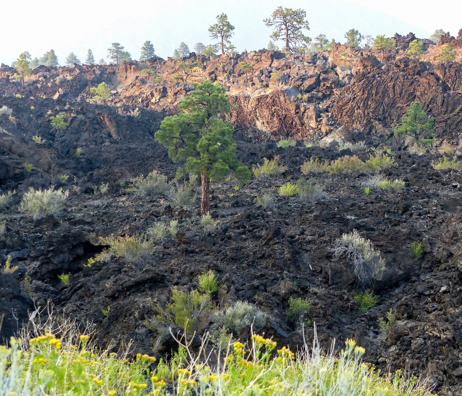
After the tour of Wupatki, we continued on the drive, noting increasing amounts of black lava rock and some evidence of old lava flows- we were nearing the Sunset Volcano portion of the monument.  Unfortunately, we had spent so much time at Vermilion Cliffs and Wupatki, the visitor center for Sunset Volcano had closed.  We were able to get some information.  This volcano erupted sometime between 1040 and 1100.  It is the most recent eruption in the 6 million year history of volcanic activity near Flagstaff.  The volcano itself is 1000 feet high.  When it erupted, ash- the lightest of the particles sprayed from the vent- for about 800 square miles.  The entire event probably lasted between 6 months and one year.  The final glow from burning cinders surrounding the vent reminded people of a sunset- thus the name.  


The sun was setting by the time we left the monument.  We arrived in Williams somewhat later than we preferred- driving in the dark on unfamiliar roads with road construction most of the way- never fun.  However, we found a great restaurant right down the street from our hotel- all was well!

The next morning, we made a decision to stay an extra day.  Time for a little golf!  We found that Elephant Rocks golf course, a course we played in 2009 and liked, was still around, so opted to play there again.  It is a tough course, but nicely kept, so fun to play.  We joined up with a couple from the Tucson area, RV'ing in the mountains to get out of the desert heat.  We enjoyed playing with them, had a beer after, and got to know their history.  One of the benefits of travel- meeting new people!  We shared our information with them, and recommended they think about traveling to the southeast on one of their trips.  Next morning, we left to head further south, to the Sedona area.  Before we left, we went through the old downtown, again one of the remnant towns the Rt. 66 still serves.  Looks like they are more prosperous than our last visit, so good to see.